
NCWRC Maps
Interactive Maps Provided by the North Carolina Wildlife Resources Commission
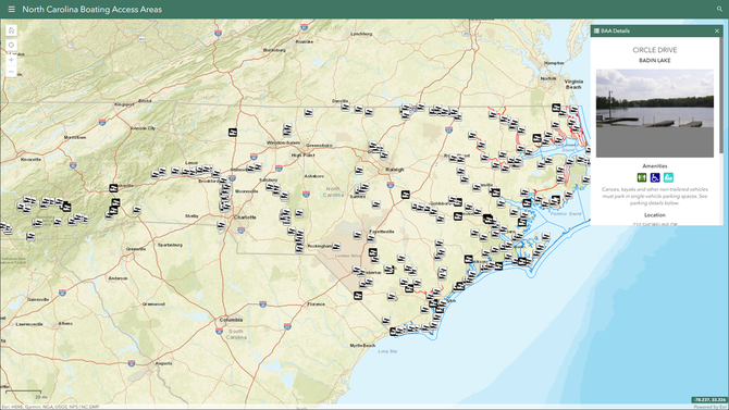
Find free and 24-hour public boat ramps operated by the Agency and its partners. Contact Land and Water Access at 919-707-0150 for more information.
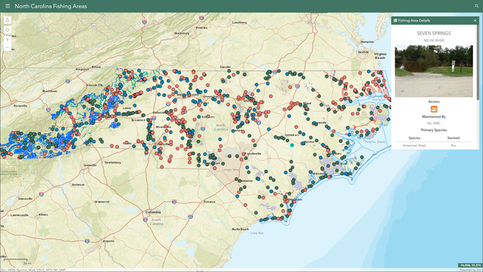
Find areas providing public fishing opportunities across the state and trout waters in Western NC. Contact Inland Fisheries at 919-707-0020 for stocking information or Law Enforcement at 919-707-0040 ext. 7 for regulatory questions.
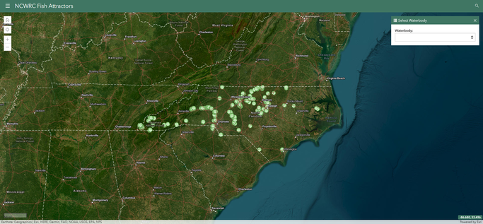
Find fish attractors on public waters placed by the Agency.
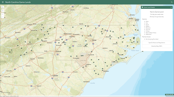
Find a Game Land, Dove Field and related access information and regulations for hunting, birding, horseback riding, and other outdoor activities on game lands. Contact Land and Water Access at 919-707-0150 for game land questions or Law Enforcement at 919-707-0040 ext. 7 for regulatory questions.
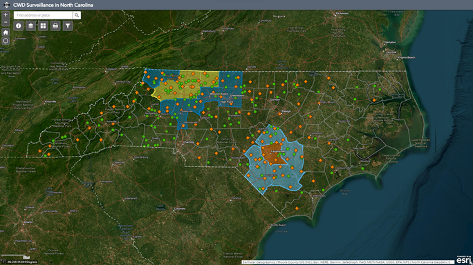
View CWD Surveillance Areas and Special Regulations. Chronic wasting disease (CWD) is a transmissible, always fatal, neurological disease that affects deer and other cervids such as elk, moose and reindeer/caribou.
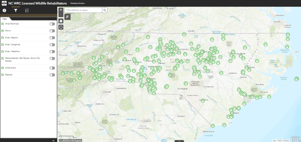
Find a nearby licensed wildlife rehabilitator. For injured and orphaned wildlife information, visit this page.
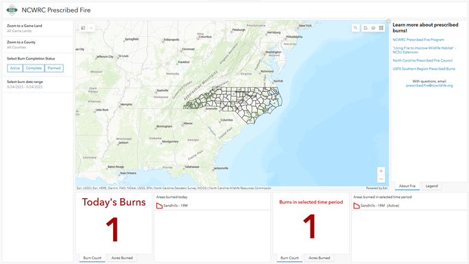
See near real time data related to the Commission’s prescribed fire program. Prescribed burns can be viewed by status (planned, active, complete), date, and location.
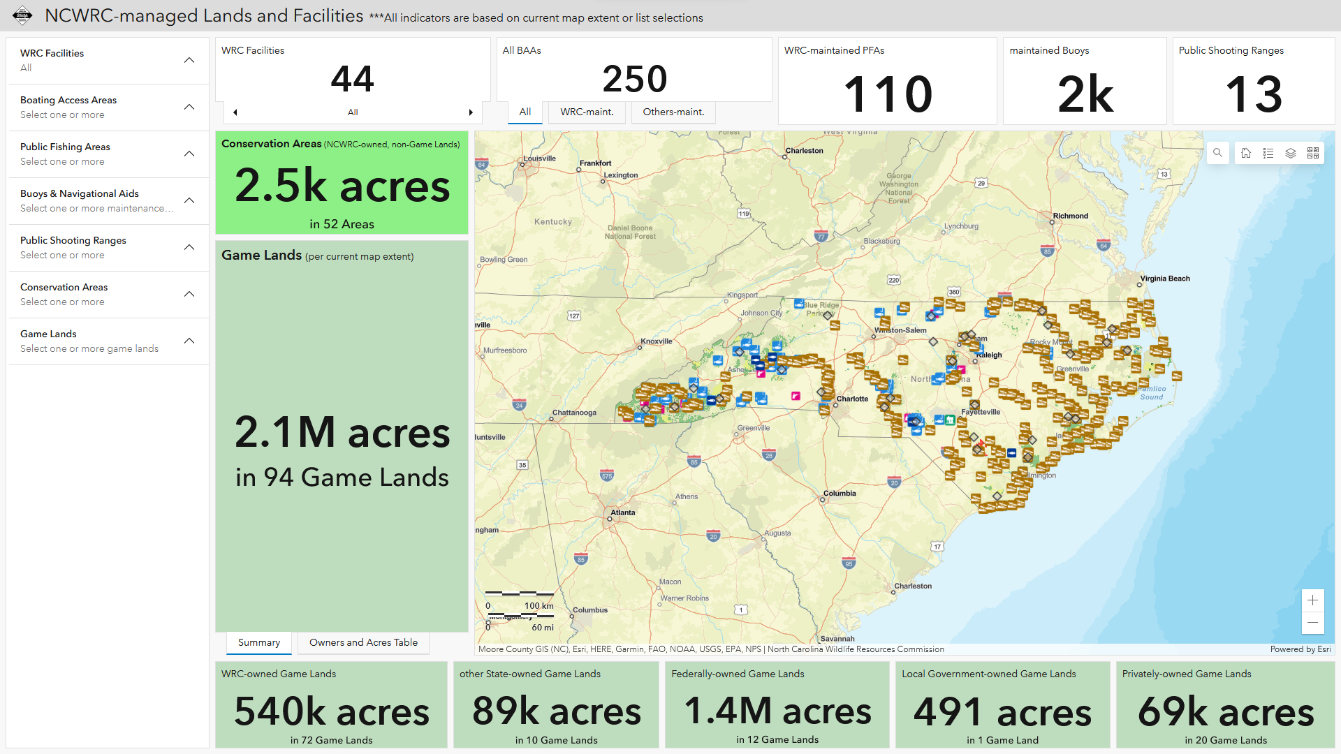
Discover location of facilities, water access areas, shooting ranges, boating safety regulated areas, managed conservation and game lands. Explore them in detail by drop-down lists, table and map selections. Turn on/off map layers and change basemaps.